Find out more

Ballina Koala Plan

Roads and Maritime, in line with expert advice has developed a strategy to address conditions of approval relating to management of the koala between Wardell and Coolgardie, near Ballina.

Key features of the strategy include:

  • Establish an expert panel to advise the Minister for Roads and Freight on modelling work and mitigation measures for the Ballina koala population
  • Engage experts to collect more data on the Ballina koala population, carry out the population viability analysis and peer review the analysis
  • Share information with key stakeholders including Ballina Shire Council and its reference group as well as the broader community.

The data collected and subsequent modelling carried out has informed development of the Ballina Koala Plan. This plan has been endorsed by the Koala Expert Advisory Committee established by Minister for Roads, Maritime and Freight Duncan Gay to provide advice on the population viability analysis modelling and mitigation measures.

Ballina Koala Plan

Frequently asked questions

Phased Resource Reduction

The Woolgoolga to Ballina Pacific Highway Upgrade Koala Management Plan proposed a staged approach to removing vegetation. This staged approach, called phased resource reduction, is being carried out in two koala hotspots in Section 10 – Laws Point and Wardell Road.

Phased resource reduction involves the gradual reduction of food resources by ring-barking and collaring trees as well as monitoring koala populations. We are doing this to encourage koalas to move into habitat areas away from construction.

The program includes five phases:

Phase 1: Tag and map all trees to be collared/ring-barked and undertake six population surveys.
Phase 2: Collar 40%, ring-bark 20% of trees with continuous canopy to feed trees, ring-bark non-collared trees (DBH 100-300mm), and conduct two population surveys.
Phase 3: Collar a further 40% of trees, continue ring-barking non-collared trees (DBH 100-300mm), and conduct two population surveys.
Phase 4: Collar the remaining 20% of trees, finalise ring-barking, and conduct two population surveys.
Phase 5: Following clearing of the hotspot site undertake eight population surveys.

Reports on the five phases in the resource reduction process are provided below:

Laws Point - Phased Resource Reduction Phase 1 - 5 Reports

Wardell Road - Phased Resource Reduction Phase 1 - 5 Reports

Koala Health Assessment

The final phase of the Phased Resource Reduction (PRR) program identified possible change in koala distribution. Sandpiper Ecological (2018) recommended a targeted survey to assess the distribution and health of koalas at key locations adjoining the W2B upgrade. Friends of the Koala (FOK) also suggested that targeted surveys be undertaken following clearing to gather additional information on koala distribution and health in vicinity of the upgrade. The aim of the surveys was to supplement the PRR koala population surveys, with a specific emphasis on the health of koalas adjoining the alignment. Key outcomes of the study were:

  • A total of nine koalas were detected within the study area as part of this assessment. This included four koalas that have previously been recorded (as part of PRR surveys) and five additional koalas that had not previously been recorded
  • The results of the Koala Health Assessment reveal positive signs for the local koala population in that in general all koalas recorded were observed to be relatively healthy, with most individuals showing no confirmed visible signs of disease or poor condition.

Koala Health Assessment

Koala Cortisol Stress Study

University of Sydney in partnership with Roads and Maritime undertook analysis of koala scats to detect changes in cortisol levels over time as construction activities progress. Scats were collected across the 5 phases of Phased Resource Reducation including the early stages of clearing. The study compares impact sites (adjacent/within alignment at Laws Point) against control sites located approximately 9km from the alignment but within the same koala population. Key outcomes of the study were:

  • no statistically significant difference in the change of cortisol concentrations between control and impact sites for each phase
  • due to low DNA yield from koala scats collected in the field, individual identification of koalas was not possible and so all findings are at the population level
  • an upward trend in cortisol concentrations was evident across both impact and control sites. Drivers of this trend could not be determined
  • ongoing monitoring of the koala populations at both the impact and control sites will ascertain if any change occurs as a result of the construction phase

Koala Cortisol Stress Study report

Koala Management Plan Progress Update

The Koala Management Plan and Ballina Koala Plan were approved in 2016. Preparation of the plans for the area between Richmond River and Coolgardie Road near Wardell was guided by the Koala Expert Advisory Committee and advice from 15 independent scientific experts. The plans set out Roads and Maritime Services’ mitigation and monitoring actions for the upgrade. This update informs the community and stakeholders about our progress on our koala protection initiatives.

Koala Management Plan Progress Update May 2020


Koala Monitoring Report

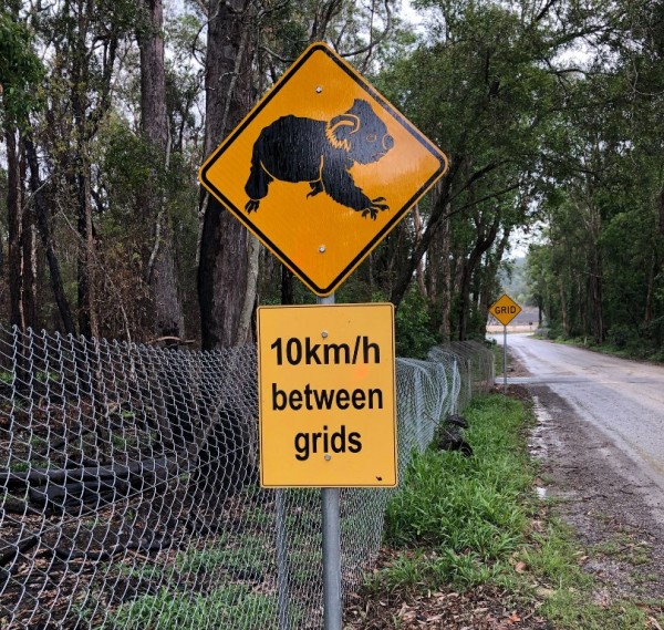
Sandpiper Ecological Surveys was awarded the koala population monitoring program for the project. The population monitoring helps us to measure the effectiveness of our mitigation measures, including the koala exclusion fencing, food tree plantings and connectivity structures. Koala monitoring is planned to continue throughout construction and well after the road opens to traffic. This will help provide an understanding of whether the mitigation measures have had an impact on the projected population decline.

Koala Monitoring Report 

Koala Revegetation Project Annual Inspection Report